Outdoors & Beaches
The Central Coast is known for ancient oaks, rolling hills and ... well ... the coast. No visit to Atascadero is complete without a scenic nature tour, a hike or cycling ride and a trip to the beach in one of our neighboring communities just over the hill. Here's our guide to all things outdoorsy.
Hiking & Cycling Trails
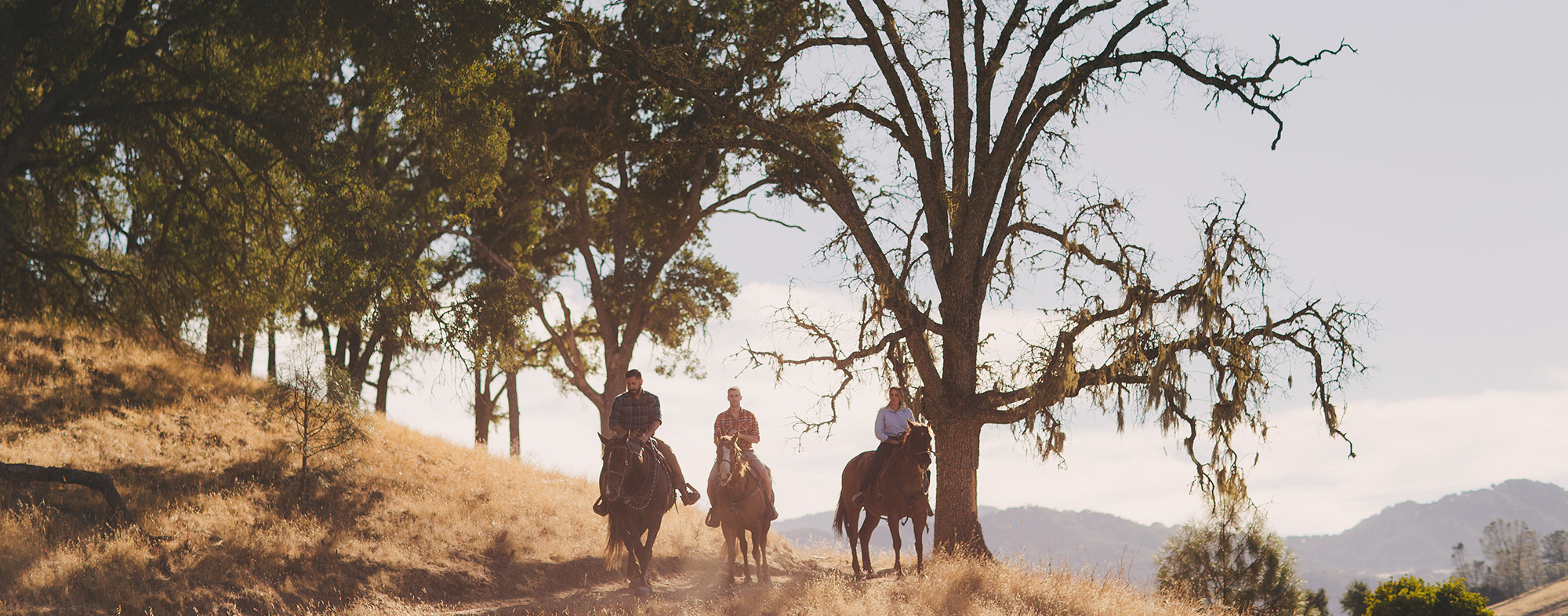
Jim Green Trail
1.7 miles, moderate, multi-use
The Jim Green trail is a very well-hidden gem in Atascadero. It is a trail that is well-suited for people, dogs, horses, and bikes. People of all ages can easily do this trail. It is a fun hike around a beautiful hill that is surrounded on one side by the Chalk Mountain Golf Course.
Stadium Park Trails
2 trail options: just under 2 miles
Usage: Equestrians, Hikers, Joggers, Mountain Bikes, Dogs
Hike Difficulty: Varies, from Blue Oak being easy to Pine Mountain being Difficult
Cerro Alto State Park (10.1 miles)
Cerro Alto Campground is a well-known hiking and mountain biking paradise. Visitors enjoy ample hiking, mountain biking and horseback riding opportunities, along with a 360-degree view of the Central California coast and inland valleys. The 4-mile Cerro Alto Trail, which leads to the peak, begins within the campground.
Santa Margarita Lake (30.2 miles)
Grey Pine: 3.3 miles one-way to Vaca Flat, moderate, multi-use
Lakeside: (unmarked)1.5 miles, dirt road along the lakeshore from Marina to White Oak, easy, multi-use
Blinn: 9.2 miles one-way (out and back mandatory), moderate to strenuous, multi-use
Sapwi: spur off Blinn after 3.4 miles, accessing Khus Camp (1 mile) and Sapwi Camp (2 miles), moderate, multi-use
Sandstone: 2.7 miles one-way (out and back mandatory), moderate to strenuous, multi-use
East River Road (Staging area for Blinn & Sandstone): 10 miles east of Santa Margarita Lake
Rocky: 1.8 miles one-way (out and back mandatory), moderate to strenuous, multi-use
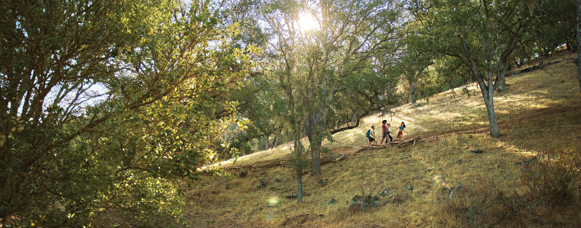
Three Bridges Oak Preserve (3 miles)
The three-mile trail system consists of both multiuse (hikers, equestrians, bicyclists) and hiker-only sections. The system begins at the 940’ elevation trailhead on the Meadow Trail across Atascadero Creek and up to the Oak Savannah Loop Trail. These two trails together create a loop trail (up and back) approximately two miles long in the lower half of the Preserve. The trail takes one through a mixed riparian habitat, a grassland meadow, and up through oak woodland populated by several different species of native California oak trees including blue oak, coastal live oak, and canyon live oak. Located on the eastern-facing slope of the property this loop trail will provide a shaded woodland hike that will be accessible and available for all ages of hikers, including children and seniors. This loop trail will be multi-use and available to hikers, cyclists, and equestrians.
Atascadero Lake Park
Marchant Avenue, Atascadero
This park is the destination of residents and visitors year-round. Atascadero’s charm is accentuated by the beautiful lake. There is a walking path that follows the edge of the lake for a stroll, jog or bike ride lakeside. The park also has a playground, paddle/kayak boats, workout stations, restroom facilities, large and small barbecue areas, horseshoe pits, a sand volleyball court and the Central Coast Zoo. For more information or to reserve a BBQ area, please call.
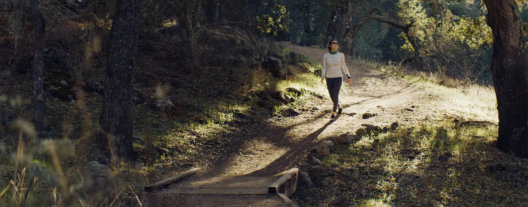
Las Lomas Nature Preserve
Calle Milano, Atascadero
The Las Lomas trail spans across open space along the hillsides surrounding the Las Lomas and La Terraza housing development. The two multi-use trails are open year-round and are dog-friendly, so bring your pup for a hike or opt for a solo bike ride through the beautiful oak and pine trees. Both the north and south trails offer scenic views of Atascadero nature.
Rinconada Trail
Pozo Rd, Santa Margarita
The Rinconada hike in Santa Margarita offers a picturesque outdoor adventure through rolling hills and oak-studded landscapes. This moderately challenging trail allows hikers to immerse themselves in the natural beauty of the Central Coast while enjoying scenic vistas of the surrounding countryside.
For more information on our hiking areas visit the San Luis Obispo County Parks Website or click here for our Atascadero Trail Guide!
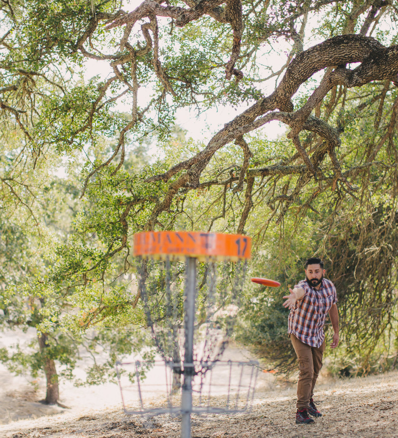
Grab Your Discs
For an absolutely gorgeous walk -- with a little competition thrown in -- head to Heilmann Park's disc golf course, which was the first 18-hole course ever built in SLO County. At about 1,300 feet in elevation, Heilmann's inland location shelters it from the ocean fog and wind. Most days here are warm, sunny and postcard-perfect. The course winds its way through a dense oak and weeping willow forest. Most of the baskets are positioned on slopes or drop-offs for an added challenge.
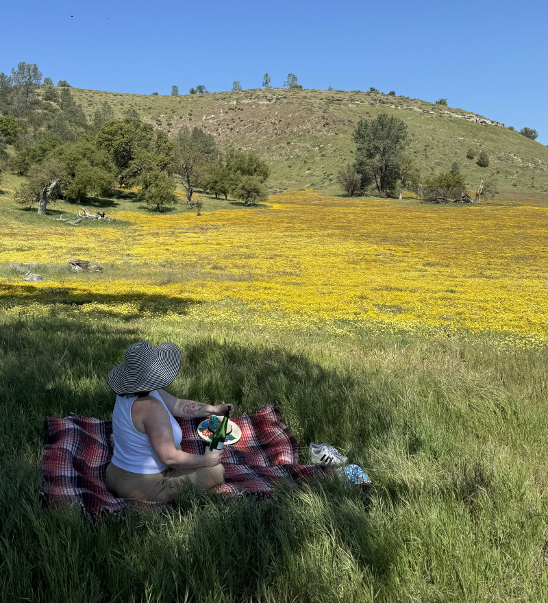
Wildflower Hunting
Atascadero is a great home base for wildflower hunting each spring, especially when there is a super bloom. The Carrizo Plains presents a breathtaking and ecologically significant landscape known for its vast open spaces and unique desert flora. Visitors can witness the stunning wildflower displays in the spring, explore the serene Soda Lake, and experience the tranquility of this remote and untouched natural wonder. Shell Creek Road is another great spot for hunting wildflowers.
Nearby Beaches
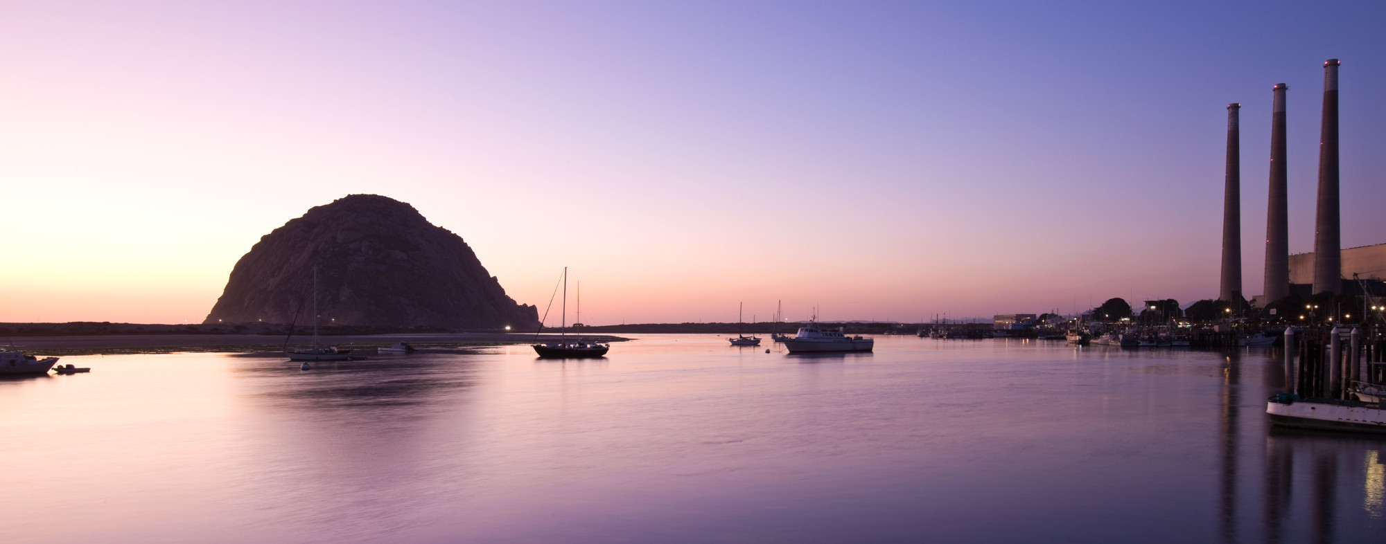
Morro Bay | 17.4 miles
The town’s most striking feature is Morro Rock, a 576-foot-high volcanic plug. Morro Rock stands at the entrance to the harbor, and a causeway connects it with the shore. Previously, it was surrounded by water, but the northern channel was filled in to make the harbor. The Rock, as locals call it, was quarried from 1889 to 1969. There is no public access to the rock itself because it is a reserve for the locally endangered peregrine falcon. However, the area around the base of Morro Rock can be visited.
Oceano | 33.7 miles
Oceano’s beach is the Oceano Dunes State Vehicular Recreation Area, a 1,500-acre (6.1 km2) coastal sand dune. As the only state park in California where visitors may drive vehicles on the beach, tourists are attracted from all over the United States. Activities on this beach include riding the sand dunes on all-terrain vehicles, swimming, clamming, camping, surfing, surf fishing, hiking, and bird watching.
Pismo Beach | 29.3 miles
The name Pismo comes from the Chumash word for tar, which was gathered from tar springs in Price Canyon near Pismo Beach. It was a valuable product used to caulk canoes. The Pismo clam was named for the long, wide beach where so many were once found. Once so abundant that they were harvested with plows on the beach, giving the city the name “Clam Capital of the World”, the Pismo clam is now greatly diminished.
Avila Beach | 27.6 miles
The beach itself is less than 0.5 miles (0.8 km) long and sheltered in San Luis Bay, which is formed by Point San Luis on the west and Fossil Point on the east. Avila Beach faces south and the 600-foot elevation of Point San Luis breaks the prevailing northwesterly winds. It is therefore usually warmer than the other beaches on the Central Coast.
Cayucos | 21.2 miles
Cayucos by-the-Sea is located on California’s scenic Central Coast, halfway between Los Angeles and San Francisco. Cayucos sits quietly between the Pacific Ocean and the rolling hillsides of open ranchland and is what some people call “the last of the California beach towns.”
Cambria | 28.7 miles
Cambria offers a variety of recreational activities such as bicycling, dog walking or hiking. Local beaches offer a venue to boogie board, surf, skimboard or relax. Ocean fishing is conducted off area beaches. Local kayak fishing tours are available.
San Simeon | 37.4 miles
San Simeon is a town on the Pacific coast of San Luis Obispo County, California. Its position along State Route 1 is approximately halfway between Los Angeles and San Francisco, each of those cities being roughly 230 mi (370 km) away. A key feature of the area is Hearst Castle, a hilltop mansion built by William Randolph Hearst in the early 20th century that is now a tourist attraction. The area is also home to a large northern elephant seal rookery.